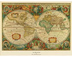
 If you are doing genealogical research or just like looking at old, historical maps this is a link you should be looking at! It’s fun and who knows what you’ll see and discover!
The U.S. Geological Survey (USGS) Historical Quadrangle Scanning Project (HQSP) is in the process of releasing all editions and all scales of more than 200,000 historic topographic maps of the United States dating from 1884-2006.
For more than 130 years, the USGS topographic mapping program has accurately portrayed the complex geography of our Nation. The historical topographic map collection contains all editions and all scales of USGS topographic quadrangles. Files are high resolution (600 DPI) scanned images of all maps from the USGS legacy collection.
The historical topographic map collection includes all States and U.S. territories mapped by the USGS. The HQSP creates a master catalogue and digital archive for all topographic maps and provides easy access to the public to download this historical data to accompany topographic maps that are no longer available for distribution as lithographic prints.
Historical maps are available to the public at no cost in GeoPDF format from the USGS Store. These maps are georeferenced and can be used in conjunction with the new USGS digital topographic map, the US Topo

